In 1990, ARPANSA conducted a nationwide survey of more than 3300 Australian homes to determine the radiation dose to the Australian population from exposure to natural background radiation, including radon. Based on this survey, the average concentration of radon in Australian homes is about 10 Bq m⁻³. This is less than in many other countries and compares to a global average indoor value of 40 Bq m⁻³. Average radon levels in Australian homes are only a little larger than the radon levels in outside air and are of minimal concern to health.
A Nation-wide Survey of Radon and Gamma Radiation Levels in Australian Homes
Indoor radon map for Australia
The survey found a very wide range of radon levels across Australia. The results have been previously reported in the form of a radon map based on postcode districts. This map has now been updated to provide district averages of radon based on the SA2 regions from the 2011 census.
This interactive radon map displays interpolated values in census districts, for typical Australian homes. While factors such as house type, construction materials and ventilation can affect the radon levels, the effect of these factors is small relative to effects due to the local geology and soil type. Taking account of the house type, the actual radon levels in a particular home may be up to a factor of two different from that shown on the map.
The radon map shows that average radon levels in homes along the Great Dividing Range are typically higher than levels in homes on the coastal plan, mainly due to differences in the nature of the underlying geology (rock and soil).
How to use the interactive map
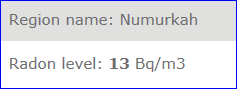
Use your mouse cursor to zoom in on the area you would like to view, then left click on the region to show a pop-up box with the average radon level (see example).
Alternatively, use the search bar in the top right corner to directly search for an address or region.
The information provided in the interactive map can also be accessed via the CSV file below. Search and locate a suburb to find the average radon level.