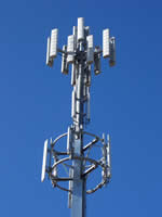
 From 2007 to 2013 ARPANSA coordinated a survey of environmental radio frequency electromagnetic energy (RF EME) levels arising from mobile phone base station antennas.
The purpose of this survey was to confirm that the highest levels of measured RF EME produced by these antennas was within the limits set by the ARPANSA radiofrequency exposure standard RPS3 and consistent with the predictions made in the Environmental EME Report relevant to that installation.
The limits in the ARPANSA Standard have been determined on the basis of established health effects and include safety margins. They are designed to protect all members of the public including those sometimes thought to be particularly vulnerable (the elderly, the infirm, pregnant women and children).
ARPANSA selected measurement sites to cover the wide range of network operators, technologies, geography and type of installations.
Measurements of the vast scale required for this survey were made possible with financial support from the Mobile Carriers Forum (MCF), a division of the Australian Mobile Telecommunications Association (AMTA). However, to maintain independence, the measurements were conducted by consultants from companies appointed by ARPANSA and accredited by the National Association of Testing Authorities (NATA). The data were obtained following the established ARPANSA measurement protocol.
The table below summarises the measurements covered by the survey and shows the levels of RF EME as a percentage of the public exposure limit set in the ARPANSA radiofrequency exposure standard. All measurements in this survey were well below the limits in the ARPANSA Standard. Further, the measurements were generally below the levels reported in the Environmental EME report.
Summary results
| Suburb/Town | Address | State | Date Measured | RF Level (% of exposure limits) |
|---|---|---|---|---|
| Merewether | Townson Oval, Merewether Street | NSW | May 2013 | 0.268% |
| Lennox Head | 20 North Creek Road | NSW | May 2013 | 3.433% |
| Skennars Head | 2A Basalt Court | NSW | May 2013 | 0.060% |
| Shepparton | 20 Fraser Street | VIC | April 2013 | 0.434% |
| Alfredton | Learmonth Street | VIC | Feb 2013 | 0.152% |
| Sunbury | The Heights, Jackson's Hill Estate | VIC | July 2012 | 1.311% |
| Maidstone | 31A Hampstead Road | VIC | May 2012 | 0.559% |
| Drummoyne | 224 Victoria Road | NSW | Aug 2011 | 1.182% |
| Ermington | 700 Victoria Road | NSW | Aug 2011 | 0.423% |
| Heidelberg Heights | 23, 27 & 33-35 Southern Road | VIC | Dec 2010 | 0.265% |
| Roxburgh Park | 180 Somerton Road | VIC | Dec 2010 | 0.315% |
| Bulleen East | 123A Thompsons Road | VIC | Jun 2010 | 1.334% |
| Calamvale | Corner of Beaudesert & Compton Roads | QLD | Oct 2009 | 0.051% |
| Palmerston | 65 Chung Wah Terrace | NT | Oct 2009 | 0.890% |
| Wynnum North | 14 Mungala Street | QLD | Oct 2009 | 0.065% |
| Holt | Playing Fields, Ormsby Place | ACT | Aug 2009 | 0.127% |
| Lalor | 320 Station Street | VIC | May 2009 | 0.194% |
| Lower Sandy Bay | Sandown Park, Long Point Road | TAS | May 2009 | 0.277% |
| Pascoe Vale | Rayner Reserve, Devon Road | VIC | Apr 2009 | 0.316% |
| City Beach | Lot 245 Kilpa Court | WA | Dec 2007 | 0.303% |
| Oaklands Park | Warradale Barracks | SA | Dec 2007 | 0.579% |
| Beaconsfield | 20 Moran Street | WA | Nov 2007 | 0.009% |
| Bli Bli | Whitecross Road | QLD | Nov 2007 | 0.026% |
| Bathurst | 230 Howick Street | NSW | Oct 2007 | <0.001% |
| Rosemeadow | Lot 1 Appin Road | NSW | Oct 2007 | 0.109% |
| South Coogee | 175 Malabar Road | NSW | Sep 2007 | 1.163% |
| Goodwood | 147 Goodwood Road | SA | Aug 2007 | 0.132% |
| Sandringham | 48 Bay Road | VIC | Apr 2007 | 0.505% |
At these low levels of exposure to RF EME, it is the assessment of ARPANSA and international health authorities such as the World Health Organisation (WHO) and the International Commission on Non-Ionising Radiation (ICNIRP) that there is no established scientific evidence to support adverse health effects.
For more information about mobile phone base stations see mobile phone base stations and health.